Vejstrup Ådal
The prominent Vejstrup Valley is one of the most beautiful valleys on East Funen with several springs.
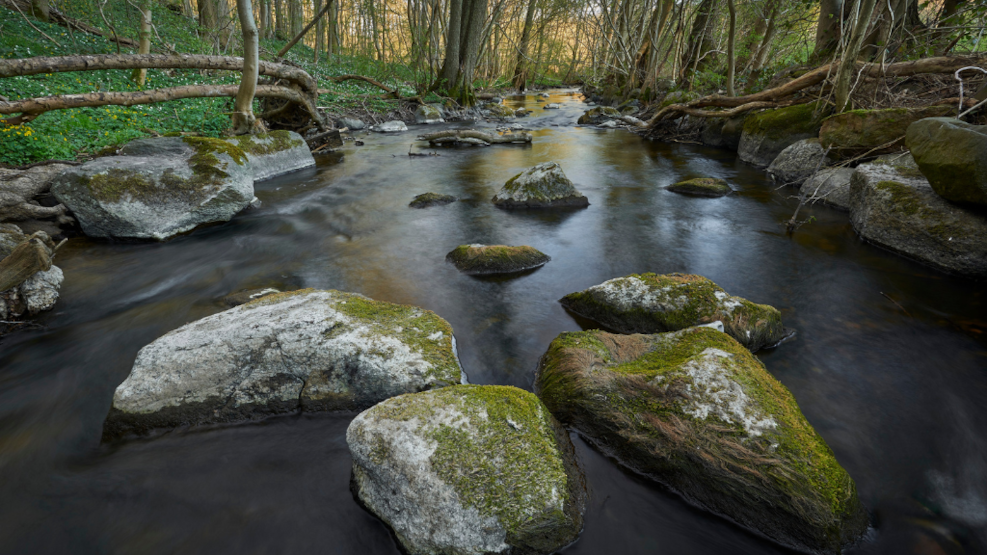
Visit Vejstrup Valley
Vejstrup Valley is located 8 km east-northeast of Svendborg and is approximately 17 km long.
There is easy access to the area from the parking lot at Lillemølle Bridge, located where the road between Svendborg and Nyborg crosses Vejstrup River. Here, you can walk along a stretch of about 4 km of the hiking trail Øhavsstien that follows the river.
What to experience at Vejstrup Valley
In addition to walking along the river and Øhavsstien, you can also visit Vejstrup Watermill, which is one of Funen's most beautiful watermills with 2 large overshot wheels. The mill can only be seen from the outside.
Geological perspectives at Vejstrup Valley
To the west, Vejstrup Valley begins in a high-lying, hilly dead ice landscape, while to the east it cuts into a moraine plain sloping towards the Great Belt. The geological history of the valley is not yet fully understood, and there have been different interpretations of its formation over time. Perhaps the valley was originally created as a tunnel valley beneath the ice by meltwater flowing westward. The water came from the part of the Baltic Ice Stream known as the 'Great Belt Glacier' (18-17,000 years ago).
After the glacier melted back, the valley apparently drained meltwater from large stagnant ice masses (dead ice) left in the terrain around the Højes Dong hills further west. The meltwater now flowed eastward, towards the Great Belt trough, and further cut into the moraine plain around Vejstrup and Øster Åby. This is how the valley acquired its current form.
Vejstrup River originates at approximately 75 meters above sea level at the foot of the Højes Dong hills. From Vejstrup to its outlet in the Great Belt, the watercourse has a drop of more than 30 meters over a distance of 4.2 km. Hydroelectric power was utilized at several locations, including Vejstrupgård, where the current watermill was built in 1838. However, there have been watermills on the site since the 1500s. The mill was originally a grain mill, and in addition to milling, there was trade in grain and fodder. As a neighbor to the watermill, there was a Dutch windmill from 1850 to 1922.
Vejstrup Valley is part of the South Funen Archipelago Geopark
In 2018, Svendborg, Faaborg-Midtfyn, Langeland, and Ærø decided to establish the South Funen Archipelago Geopark with the aim of being designated as a UNESCO Global Geopark. The purpose of the geopark is to create and preserve an area that accommodates both humans and nature.
A UNESCO Global Geopark should bring the geology, nature, and cultural history of an area into play and convey a message that humans are part of life on Earth. That we all depend on the Earth's resources, are affected by climate change, and are responsible for sustainable development.
The South Funen Archipelago Geopark tells the story of a dramatic sea-level rise in Southern Funen and the islands. A sea-level rise that shaped a very special nature, which for the last few 10,000 years has formed the basis for the area's existence and cultural identity. It is the story of how the landscape and archipelago continue to change and define how we as humans live today. And the South Funen Archipelago Geopark is primarily about understanding how, through sustainable development, we can continue to protect our special geological, biological, and cultural heritage.